This project is part of Última 09, in which we proposed to create a mural result of a research process with the territory (Priorat region, in the Tarragona province. This post shows the result of that process.
Working process
The Priorat is one of the least populated regions of Catalonia. However, a living area around three main themes: wine, landscape and the energy sector , with a strong role of local social movements in the struggle. The Platform brings together the efforts around environment, works to protect the heritage landscape, ecological and cultural. One of the initiatives promoted is to ask the county for the status of Cultural Heritage of Humanity, to protect their ways of life rooted historically.
So, we asked ourselves two questions:
- Is the Priorat region building a Theme Park of the Authentic?
- What’s the other side of the coin?
So what we intend to investigate further, we intend to reflect on aspects that complement this release explained, only a part of the Priorat.
The methodologies of the work process were the following:
- Meetings arranged with key informants.
- E-mail surveys
- Socio-geographical detorunements
- Query secondary sources of information
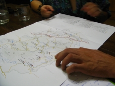
- Preparation of draft maps
Arranged meetings with key informants
From the cultural and local social movements.
Surveys by email
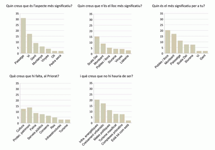
The survey was conducted during October 2009 via email asking 85 people five questions related to the region.
Socio-geographical détorunements
The socio-geographical détorunements are another important part of the investigation, as they conducted us to produce much of the artwork and enabled setting a concept map to summarize basic information.
The détorunements is a technique of psychogeography, pseudo-science created by the Situationists in the late 50 that seeks to cross-examine the city. According to Debord’s words,
“The détorunmenent is presented as an uninterrupted passage through various environments. The concept of the détorunement is inextricably linked to the recognition of effects of psychogeographical nature, and the affirmation of a playful-constructive behavior, which opposes all aspects of the classic notions of journey and walk”
(Theory of the détorunement, Guy Debord, 1958). (The translation is ours).
We used the neologism “socio-geographical” to denote that our procedures have not been led by emotions and feelings of the researcher, but the emotions and feelings shared by a significant portion of Priorat, factors to which necessarily we add random and our decisions. The result, therefore, put on the table the shared significance of various aspects of the territory.
First détorunement
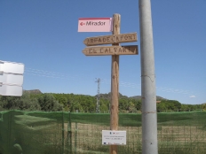
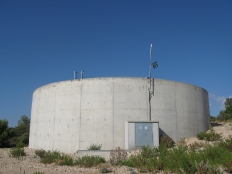
Highlight the contact that we could have with people involved in social and cultural movements in the area, which allowed us to refine the view to everything related to landscape impacts: the windmills of Coll de la Teixeta, water tanks in La Figuera, or mismanagement of cultural heritage. We were also able to grasp the massive presence of everything related to the wine cellars, vineyards, tours… and be aware of the existence of the wash houses on the outskirts of villages and the Flors de Maig as a culturally active nodes.
Second détorunement
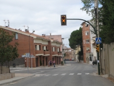
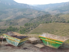
We went deeper into the issues that had been raised before: we visited the abandoned house of the Mines of Bellmunt, where they could have the set up the Priorat Centre d’Art headquarters, we made a special track to deposits, as impacts to the landscape but also as places where people could enjoy the abundant water (swimming, …). On this second visit appeared some recurring issues such as the very few outdoor paintings and abundance of walls, besides the traffic light of Falset, the only of the district and that, moreover, we saw that only is used in amber. Finally, we came out throug Coll d’Alforja, a privileged place to observe the Montsant mountains, but as a counterpoint, suffers a huge quarry hole.
Third détorunement
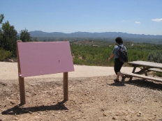
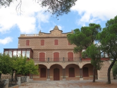
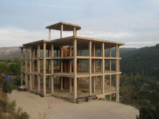
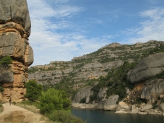
At this point, we had the results of surveys and other documentation, such as the Carta del Paisatge del Priorat, from where we wanted to use the “points of observation and enjoying the landscape.” We went to see spots we had not yet visited among those highlighted as significant. For example, Siurana because of its spectacular scenery, but also for being the only place where we saw foreigners. Also, apart from the “contained nature” of Fraguerau, we made a discovery that condenses the current tensions in the Priorat: a skeleton of what should be a hotel contemplating a majestic landscape. We also made a sketch of some features of the character of the area, including the fact that the “try not to make vinegar.”
Query of the secondary sources of information
In the project’s document you can find a part dedicated to compile these sources.
Preparation of drafts
Maps on what went dump several aspects: the results of the survey, the routes followed and other data.
Online version:
Mapa online del priorat [width=730;height=440]
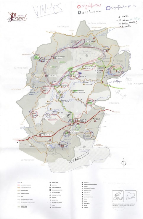
Hacked version of the map of Wine Landscapes (Tourist Map of the Priorat).
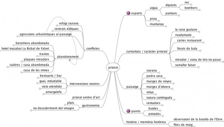
The following outline is a mental map concept that brings together several photos taken during the investigation, grouped by topic into categories. These categories include, for example, what we saw as character traits, or more landscape related topics.
Results
The results of these surveys and of our own investigations imposed us the map, and not the painting a wall, the final format as most suitable for the project.
Socio-geographical map abstract Priorat (meaning points)

The first map is done based on feedback from our surveys and observations. The map is more abstract since, it has no legend, is a simple relationship of colors and sizes situated geographically over a backround that surrounds any particular territory.
Socio-geographical Priorat map (meaning points)

The second map is less artistic because it has a much clearer role, since it incorporates a legend. It incorporates information from the Catalog of Landscape (observation and enjoyment points).
Socio-geographical Priorat map (Significance pies)

The third map wants to keep its information soul but also gather informative pie graphics, where size and color of its portions complements quantitative information.
Socio-geographical Priorat map (significance levels)

The fourth map abandons the more statistical aesthetic to approach geography. Here, the darker areas denote the greatest significance. These areas may well be objectivated territorial fragments (such as Montsant mountains) or others, as ” view from the Coll d’alforja the Montsant mountains” that have emerged repeatedly in the polls.
Socio-geographical Priorat map

In this map we incorporate the information that we were not able to reflect on the others. Through signs and, above all, we believe, the examples showed in the right column, plus the results of the survey, we tried to give a global idea of our work: a map, or a guide that serves as a guidelook beyond wine. Obviously not a list of all spots and issues that have emerged. There are many impacts on landscape or topics that may be relevant that we didn’t find. But however, these deficiencies are also important. Why’s not there what is not there?
Socio-geographical Priorat map
Conclusions
We wanted to make a map of what is not good to show, what is not tourist related, and a counterpoint to what is politically innocuous.
Towards a socio-geographical map of the region
Download file (PDF 9,88 Mb in catalan)

